Skip to content

Grundstücke

On the App Store as: Flurstück & Grundstücksgrenzen (German)

Where does my property actually end? Most people do not know. I put the boundaries from the surveying offices of 15 German states on one map, and outdoors an arrow leads you to the boundary stone. On top comes everything else the authorities know about that exact piece of land: what the ground is worth, whether a zoning plan applies, whether it floods, whether fibre is available.
View on the App StoreHelp page (German)Version 1.4.1, November 2026
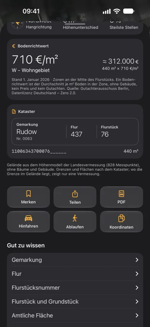
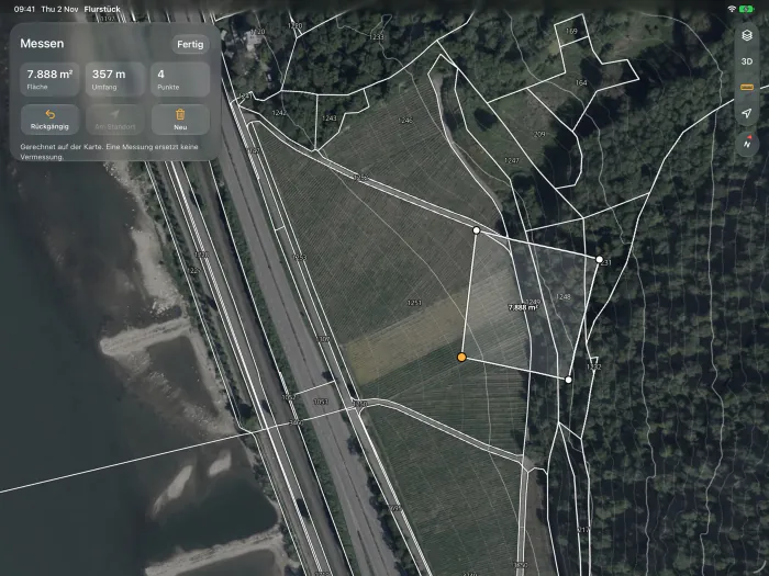
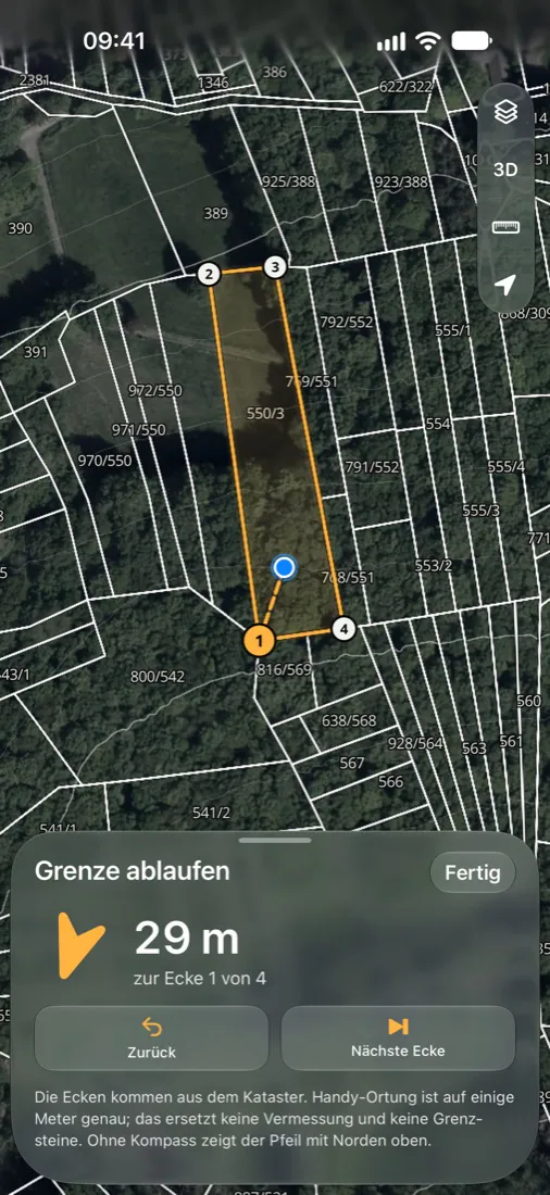
Grundstücke on the iPad: a land parcel measured on the aerial imageGrundstücke on the iPhone: walking the boundary, an arrow shows the next corner 29 metres awayGrundstücke on the iPhone: official land value of 710 euros per square metre

What it is about

Anyone who owns, buys or inherits land in Germany asks the same questions: where exactly is the boundary, what is the ground worth, what rules apply there? The answers exist, but they are spread across surveying offices, valuation committees and thematic maps, and every state publishes them differently.

The app brings them together for one single parcel. You tap a plot and see its boundary, area, elevation and slope.

How it works

  • Walk the boundary: outdoors an arrow leads you from corner to corner. Close to a corner the iPhone vibrates and shows where to look. You record the boundary stone with a photo and a note.
  • Land value: in 12 states, calculated for the size of the plot with the conversion rules of the valuation committee.
  • Property check: eight topics from official maps for this exact plot: zoning plan, heritage protection, nature and water protection, flooding, heavy rain, noise, radon.
  • Connectivity: whether fibre reaches the plot and which carrier has 5G or 4G there, based on data from the Federal Network Agency.
  • Export: boundary and points as GPX, KML or GeoJSON, for Garmin, Google Earth or QGIS.

What was hard

Every state delivers differently

15 surveying offices means 15 services with their own formats, their own names and their own gaps. The app turns them into one map on which every parcel feels the same. Bavaria is missing: its boundaries are not available as open, queryable data.

Staying honest when the source is silent

If the state lists no zoning plan, that does not mean none applies. The app therefore says "no plan" only where that is documented. Otherwise it says what the state reports and who can give a binding answer. For this it knows, besides the state collection, the plan lists of many towns and municipalities, which also contain older plans.

There is often no signal outdoors

In a forest, a map that still has to load is useless. Your own plots with aerial image and boundaries, points with photos and the emergency rescue points therefore work offline.

Where the idea came from

The idea came out of my own analysis of App Store search: I measure what people search for and where the existing apps are weak. The first run started with 676 seed words, which became 5,574 search terms and 4,627 analysed result lists. Three ideas were left at the end. Land boundaries were added in a later run.

Key facts

On the App Store since
November 2026
Runs on
iPhone and iPad
Built
solo
Tech
Swift, SwiftUI, MapKit, SQLite, CloudKit, Cloudflare Workers